Around the CityOkolo mesta

The Villages Around NitraObce okolo Nitry

A dense ring of farming villages, vineyard settlements and old market lanes presses right up against Nitra. Some are boroughs of the city now, swallowed during the twentieth century; others are independent municipalities with their own mayors and councils. All of them are still built around a church, a cemetery and one long main street.Okolo Nitry sa tesne zviera hustý veniec poľnohospodárskych dedín, vinohradníckych osád a starých ulíc. Niektoré sú dnes mestskými časťami, ktoré mesto pohltilo v priebehu dvadsiateho storočia; iné zostali samostatnými obcami s vlastným starostom a zastupiteľstvom. Všetky sú však stále postavené okolo kostola, cintorína a jednej dlhej hlavnej ulice.

The Ring Around NitraVeniec okolo Nitry

Where the City Stops Being a CityTam, kde mesto prestáva byť mestom

Nitra sits at a hinge in the Slovak landscape. To the east and north-east the wooded ridges of the Tribeč rise abruptly out of the plain, with Zobor — the city’s own hill — standing at their south-western tip. Everywhere else the land falls open into the Danubian lowland: the wide, slow valley of the Nitra river running south, and beyond the hills the parallel valley of the Žitava. It is some of the most fertile ground in the country, and it has been farmed continuously for a very long time.Nitra leží na pomedzí dvoch krajín. Na východe a severovýchode sa z roviny prudko dvíhajú zalesnené hrebene Tribeča a na ich juhozápadnom konci stojí Zobor — vlastný vrch mesta. Všade inde sa krajina otvára do Podunajskej nížiny: široké, pomalé údolie rieky Nitry smerujúce na juh a za kopcami súbežné údolie Žitavy. Je to jedna z najúrodnejších pôd v krajine a obrába sa tu nepretržite už veľmi dlho.

That fertility is why the villages sit so close together. Walk or cycle out of Nitra in any direction and within a few minutes the housing estates give way to fields, and within a few more a church tower appears above a line of poplars. The pattern repeats the whole way round the city — vine rows on every south-facing slope under the hills, grain and maize on the flat land, orchards and kitchen gardens behind every house.Práve tá úrodnosť je dôvod, prečo dediny ležia tak blízko pri sebe. Vyjdite alebo vyjdite na bicykli z Nitry ktorýmkoľvek smerom a po pár minútach vystriedajú sídliská polia a po ďalších pár sa nad radom topoľov objaví kostolná veža. Ten vzor sa opakuje dokola okolo celého mesta — vinohrady na každom svahu obrátenom na juh pod kopcami, obilie a kukurica na rovine, sady a záhrady za každým domom.

Borough or municipality? The difference is the whole point. Half the places in this ring are no longer villages at all in the administrative sense. During the twentieth century Nitra absorbed the settlements that had grown up around it, and they became city boroughsmestské časti — of Nitra: Dolné Krškany, Horné Krškany, Dražovce, Janíkovce, Mlynárce, Párovské Háje and Kynek among them. They have a Nitra address and a Nitra council, but on the ground they still read as villages: a single spine of a street, a churchyard, a fire station, allotments at the back.Mestská časť, alebo obec? Práve na tomto rozdiele všetko stojí. Polovica miest v tomto venci už z administratívneho hľadiska vôbec nie je dedinou. Nitra počas dvadsiateho storočia pohltila sídla, ktoré okolo nej vyrástli, a stali sa z nich mestské časti Nitry: okrem iných Dolné Krškany, Horné Krškany, Dražovce, Janíkovce, Mlynárce, Párovské Háje a Kynek. Majú nitriansku adresu a nitrianske zastupiteľstvo, no v teréne pôsobia stále ako dediny: jedna hlavná ulica ako chrbtica, cintorín pri kostole, hasičská zbrojnica a záhrady vzadu.

The rest are independent municipalitiessamostatné obce — each with its own mayor, its own council and its own village office. Ivanka pri Nitre, Lužianky, Nitrianske Hrnčiarovce, Štitáre and a few dozen more belong to the Nitra district but not to the city. Several of them touch Nitra’s built-up edge so closely that a visitor would never guess where one ends and the other begins — but the line is real, and locals are quite clear about which side of it they live on.Ostatné sú samostatné obce — každá s vlastným starostom, vlastným zastupiteľstvom a vlastným obecným úradom. Ivanka pri Nitre, Lužianky, Nitrianske Hrnčiarovce, Štitáre a ďalšie desiatky patria do okresu Nitra, ale nie do mesta. Niektoré sa dotýkajú zastavaného okraja Nitry tak tesne, že návštevník by nikdy nepovedal, kde jedna končí a druhá začína — no tá hranica je skutočná a domáci veľmi presne vedia, na ktorej strane bývajú.

The same street, the same church, the same fields — and two completely different postal addresses.Tá istá ulica, ten istý kostol, tie isté polia — a dve celkom odlišné adresy.
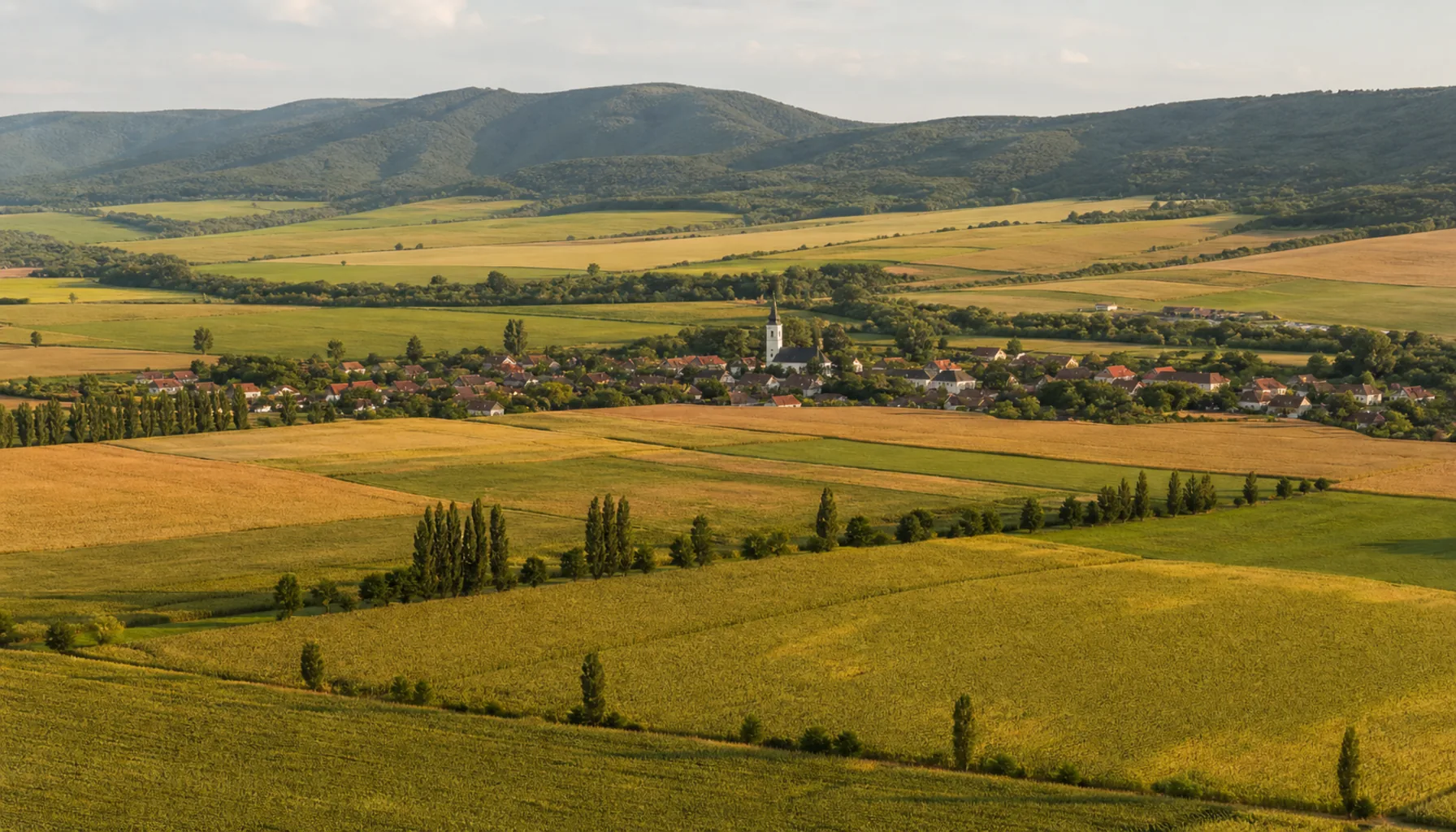
The farmed plain around Nitra, with village roofs and a church tower set against the Tribeč ridges
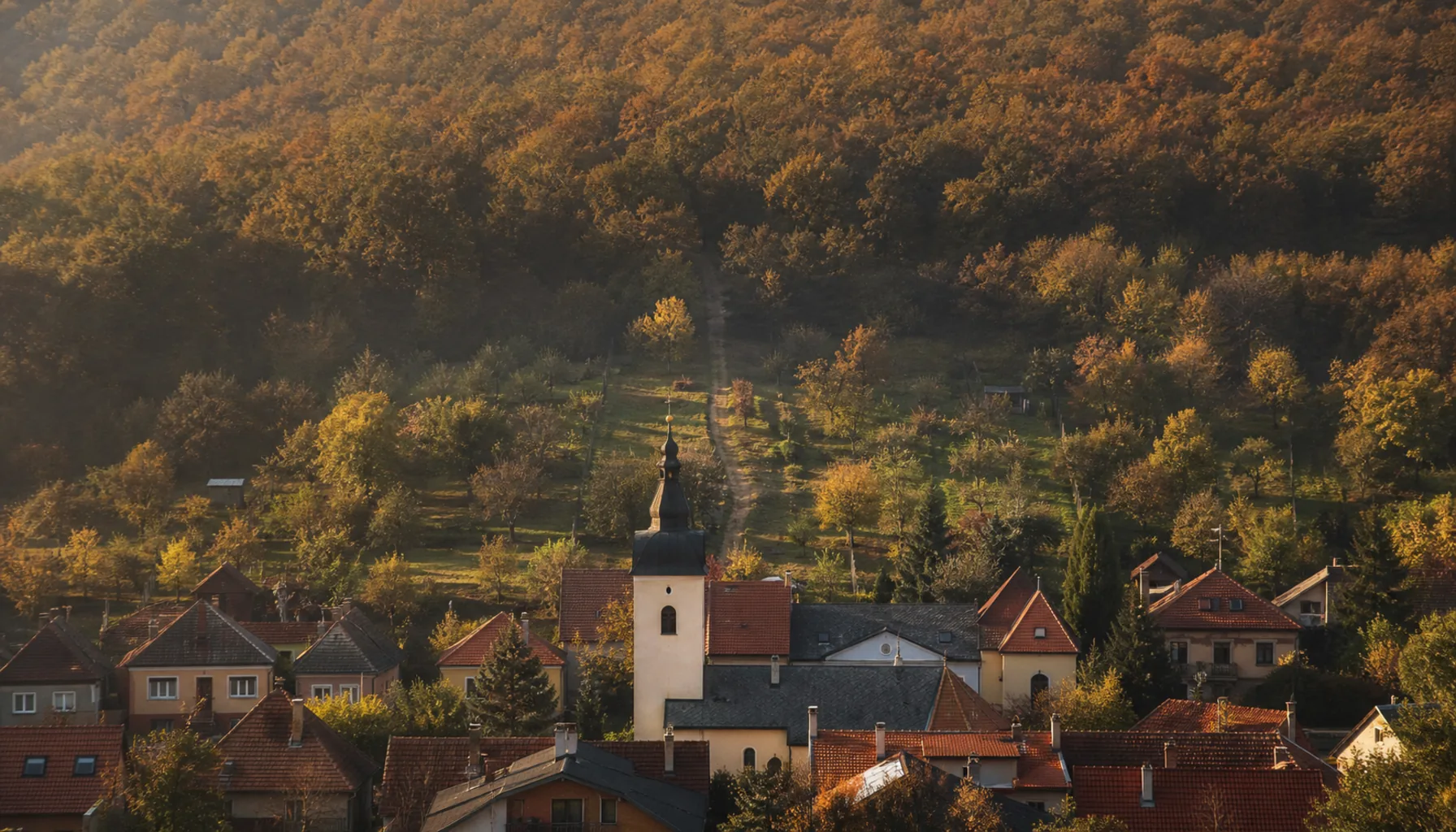
The farmed plain around Nitra, with village roofs and a church tower set against the Tribeč ridges.Obrábaná rovina okolo Nitry so strechami dediny a kostolnou vežou na pozadí hrebeňov Tribeča.
Dolné Krškany — a city boroughDolné Krškany — mestská časť

The Southern Edge, Where the Rails BeginJužný okraj, kde sa začínajú koľajnice

Dolné Krškany — literally “Lower Krškany” — lies at Nitra’s southern limit, on the flat ground where the Nitra river leaves the city and the railway running south leaves with it. It was a village of its own for centuries, the lower half of a pair with Horné Krškany just up the road, and it was taken into the city during the twentieth century. It is a borough now, but nobody who walks its older streets would call it anything but a village that a city grew over.Dolné Krškany ležia na južnej hranici Nitry, na rovine, kde rieka Nitra opúšťa mesto a spolu s ňou odchádza na juh aj železnica. Po stáročia to bola samostatná dedina, dolná polovica dvojice s Hornými Krškanmi kúsok vyššie pri ceste, a mesto ju pripojilo v priebehu dvadsiateho storočia. Dnes je to mestská časť, no nikto, kto prejde jej staršími ulicami, by ju nenazval inak než dedinou, ktorú prerástlo mesto.

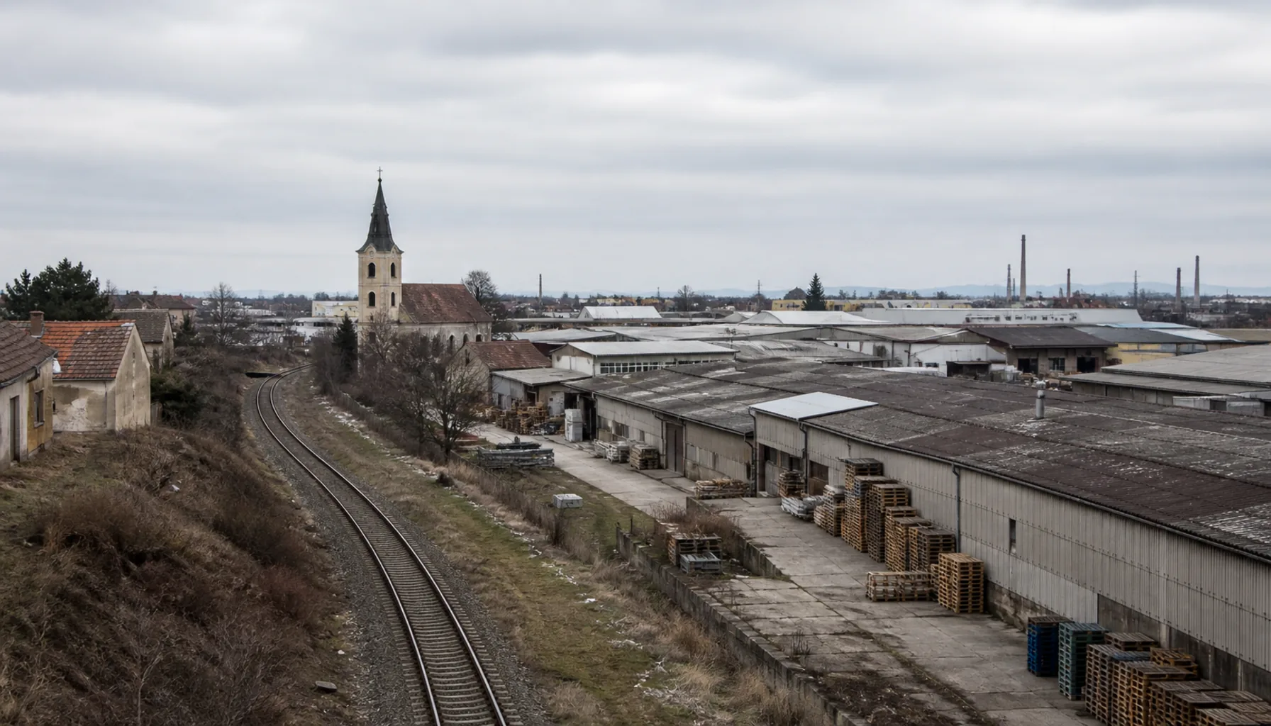
What the railway brought was industry. The land south of Nitra is flat, cheap to build on and threaded by both the rail line and the road running south-east toward Vráble — so this is where the works went. Today Dolné Krškany is the blunt end of the city: engineering halls, timber and builders’ yards, cold stores, logistics depots, haulage companies and the long anonymous sheds of light manufacturing, with lorries queuing at the gates on a weekday morning. It is not pretty, but it is where a great deal of Nitra actually goes to work.Železnica sem priniesla priemysel. Pôda na juh od Nitry je rovná, lacná na zastavanie a pretkaná tak železnicou, ako aj cestou smerujúcou na juhovýchod k Vrábľom — a tak sa závody usadili práve tu. Dnes sú Dolné Krškany tvrdým koncom mesta: strojárske haly, drevené a stavebné sklady, chladiarne, logistické areály, dopravné firmy a dlhé anonymné haly ľahkej výroby, pred bránami ktorých sa v pracovné ráno radia kamióny. Nie je to pekné, ale práve sem chodí veľká časť Nitry naozaj pracovať.

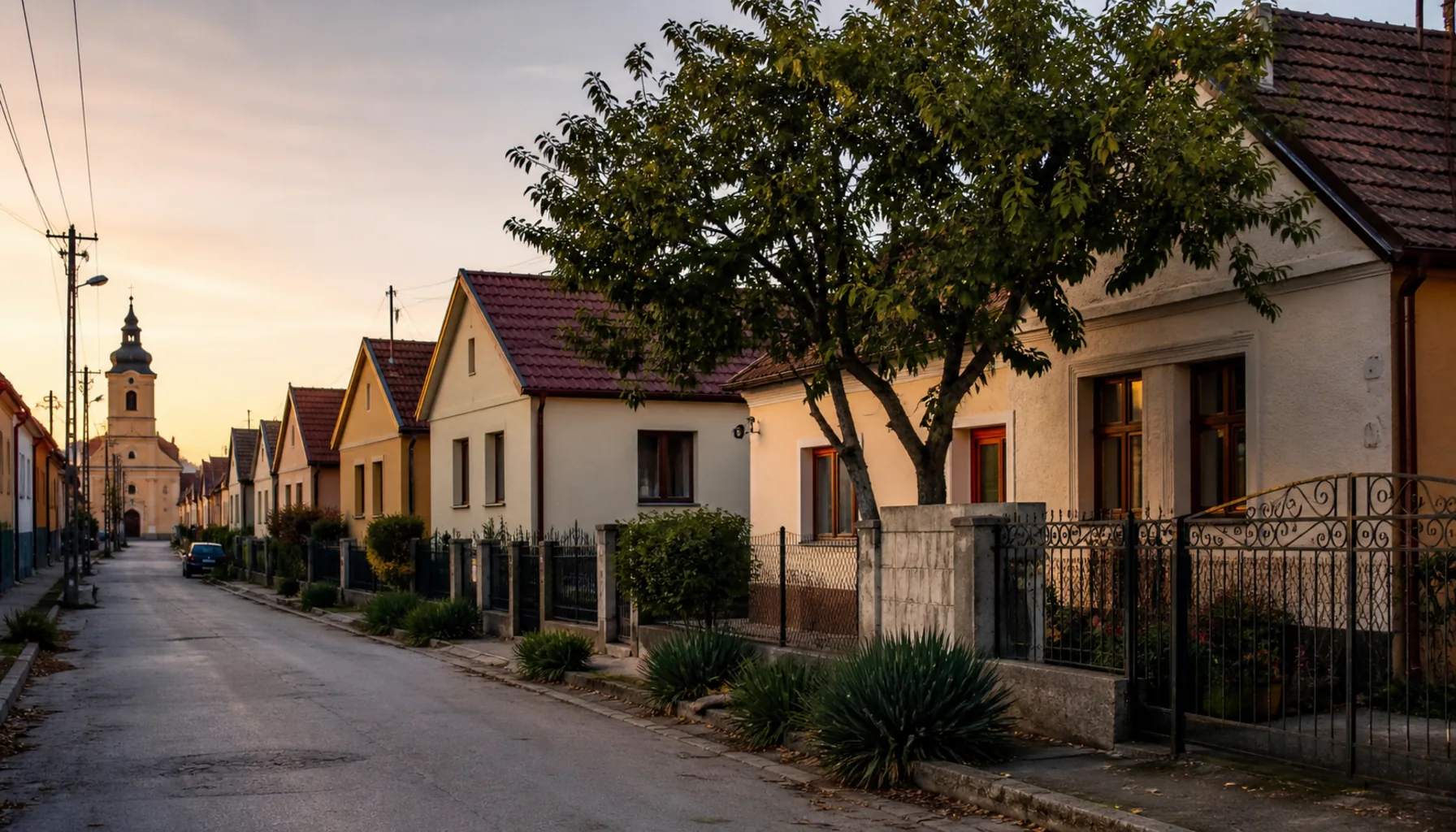
And between the yards, the village survives. Turn off the main road and you find the old lanes still there — single-storey houses standing gable-end to the street, deep narrow plots running back to the gardens, a churchyard, a war memorial, a pub. The two halves sit side by side without much comment: a warehouse gate, then a garden gate, then another warehouse gate.A medzi areálmi dedina prežíva. Odbočte z hlavnej cesty a nájdete staré uličky presne tam, kde boli — prízemné domy stojace štítom do ulice, hlboké úzke parcely siahajúce až k záhradám, cintorín pri kostole, pamätník padlým, krčma. Obe polovice existujú vedľa seba bez veľkých rečí: brána skladu, potom záhradná bránka a potom zase brána skladu.

Dolné Krškany — the industrial belt on Nitra’s southern edge, warehouse roofs and rail track running out toward the plain
Dolné Krškany — the industrial belt on Nitra’s southern edge, warehouse roofs and rail track running out toward the plain.Dolné Krškany — priemyselný pás na južnom okraji Nitry, strechy skladov a koľajnice miznúce v rovine.

The companies of the Krškany industrial belt →Firmy krškanského priemyselného pásu →

Horné Krškany — a city boroughHorné Krškany — mestská časť

The Upper Half of the PairHorná polovica dvojice

Horné Krškany — “Upper Krškany” — is the twin of Dolné Krškany, lying immediately to the north of it and therefore closer to the centre of Nitra. The two were a matched pair long before either was a borough: one Krškany estate that split into an upper and a lower village, worked the same fields, buried its dead within sight of the same river, and was drawn into the growing city in the same century.Horné Krškany sú dvojčaťom Dolných Krškian; ležia hneď severne od nich, a teda bližšie k centru Nitry. Obe tvorili pár dávno predtým, než sa z nich stali mestské časti: jeden krškanský majetok, ktorý sa rozdelil na hornú a dolnú dedinu, obrábal tie isté polia, pochovával svojich mŕtvych na dohľad od tej istej rieky a v tom istom storočí ho pohltilo rastúce mesto.

Being the nearer of the two, Horné Krškany came under the city’s residential pressure first, and it shows. The character here is more domestic than at its lower twin: family houses on their own plots, newer infill among the old village frontages, gardens, children walking to school. But it shares the same southern industrial edge — the works, yards and transport depots that define this side of Nitra do not respect the boundary between the two Krškany, and a single street can run from a row of village cottages straight into a loading bay.Keďže sú z tej dvojice bližšie k mestu, Horné Krškany zasiahol rezidenčný tlak ako prvé — a je to vidieť. Charakter je tu domáckejší než u dolného dvojčaťa: rodinné domy na vlastných pozemkoch, novšia zástavba vklinená medzi staré dedinské priečelia, záhrady, deti idúce pešo do školy. Delí sa však o ten istý južný priemyselný okraj — závody, areály a dopravné základne, ktoré definujú túto stranu Nitry, hranicu medzi oboma Krškanmi nerešpektujú a jedna ulica dokáže prejsť z radu dedinských domčekov rovno k nakladacej rampe.

For a visitor, the pair is worth an hour on foot precisely because of that seam. Walk from Horné down to Dolné and you cross, in a few hundred metres, from suburban Nitra into the working city and out again into a village street that has not moved since before either existed.Pre návštevníka stojí táto dvojica za hodinu pešej chôdze práve pre ten šev. Prejdite z Horných dolu do Dolných a na niekoľkých stovkách metrov prekročíte hranicu z predmestskej Nitry do pracujúceho mesta a zase von na dedinskú ulicu, ktorá sa nepohla od čias, keď ani jedno z toho neexistovalo.

Horné Krškany — a village street of gable-end houses and front gardens absorbed into the city
Horné Krškany — a village street of gable-end houses and front gardens absorbed into the city.Horné Krškany — dedinská ulica domov so štítmi a predzáhradkami, pohltená mestom.
Ivanka pri Nitre — an independent municipalityIvanka pri Nitre — samostatná obec

The Manor Village East of the CityKaštieľna obec na východ od mesta

Ivanka pri Nitre stands a short drive east of Nitra on the flat, open land that runs away toward the Žitava. It is not a borough: it is an independent municipality with its own mayor and council, and it takes that independence seriously even though Nitra’s eastern suburbs now reach almost to its fields.Ivanka pri Nitre leží kúsok autom na východ od Nitry na rovnej otvorenej pôde, ktorá sa tiahne smerom k Žitave. Nie je to mestská časť: je to samostatná obec s vlastným starostom a zastupiteľstvom a svoju samostatnosť berie vážne, hoci východné predmestia Nitry už siahajú takmer k jej poliam.

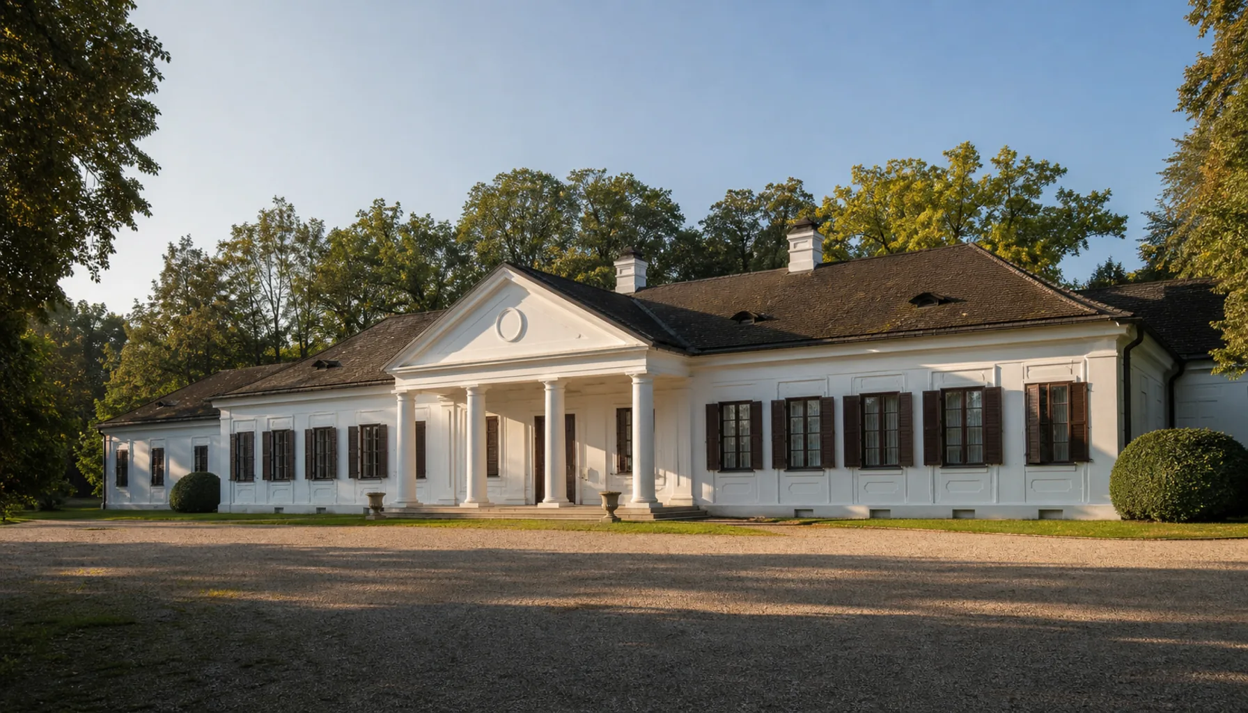
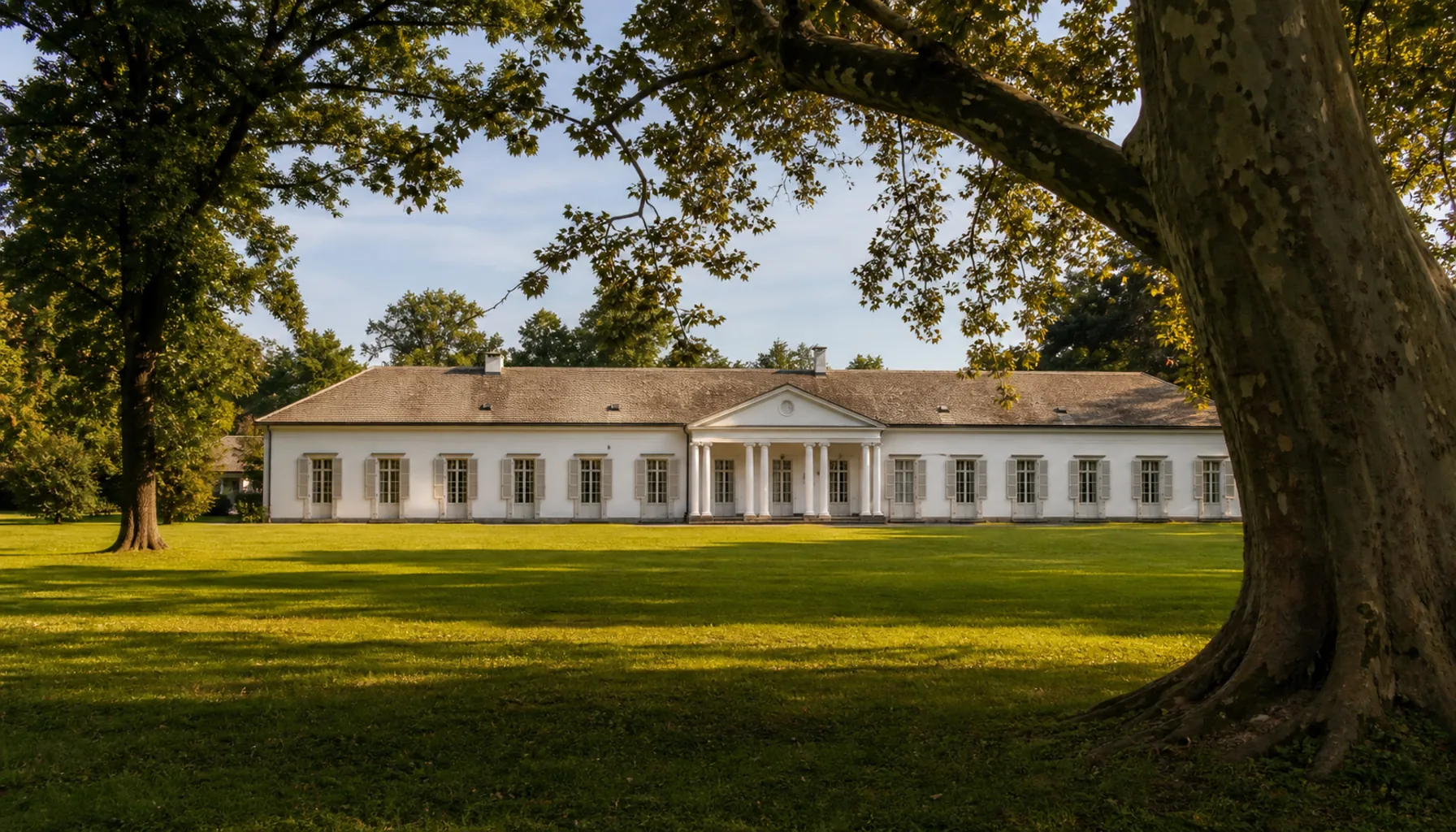
At the heart of the village stands its classicist manor house — a kaštieľ of the restrained, symmetrical kind that landowning families built across the Hungarian lowlands in the late eighteenth and early nineteenth centuries: a long low frontage, a columned centre under a pediment, and behind it a park of old broadleaf trees. The park is the village’s green room, the place where the shade is in August and where the village walks on a Sunday.V srdci obce stojí klasicistický kaštieľ — striedma, súmerná stavba toho druhu, aký si zemianske rodiny stavali po celej uhorskej nížine na konci osemnásteho a začiatku devätnásteho storočia: dlhé nízke priečelie, stĺpový stred pod tympanónom a za ním park starých listnatých stromov. Park je zelenou sálou obce, miestom, kde je v auguste tieň a kam sa v nedeľu chodí prechádzať.

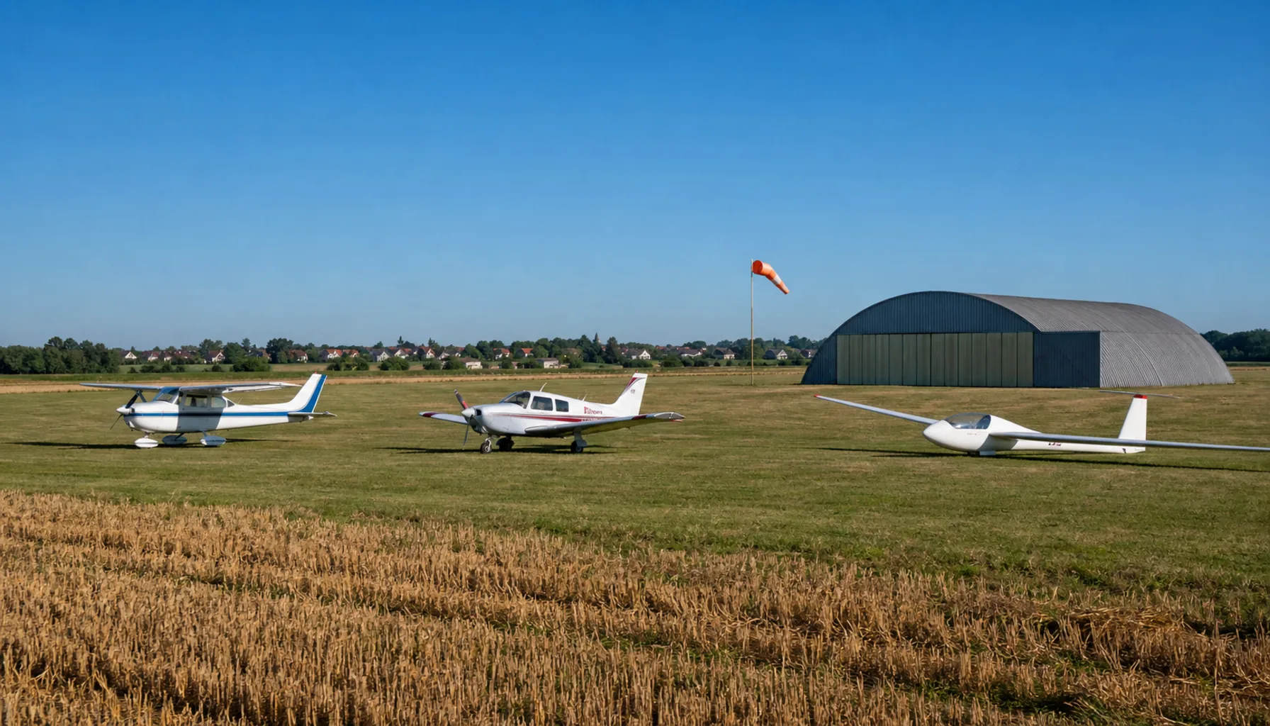
Ivanka has an unusual neighbour: Nitra’s airfield, which lies just beside it in the neighbouring borough of Janíkovce. It is a small general-aviation field rather than an airline airport — light aircraft, gliders, flying club activity, the occasional air day — and on a clear weekend the sound of a single engine turning over the fields is part of the village’s soundtrack.Ivanka má nezvyčajného suseda: nitrianske letisko, ktoré leží hneď vedľa nej v susednej mestskej časti Janíkovce. Nie je to letisko pre linkovú dopravu, ale malé letisko všeobecného letectva — športové lietadlá, vetrone, činnosť leteckého klubu, občasný letecký deň — a za jasného víkendu patrí zvuk jediného motora krúžiaceho nad poliami ku zvukovej kulise obce.

What Ivanka has become, in the last generation, is a commuter village. New family houses have gone up on the edges as Nitra’s working population looked for a garden and a quieter street within a quarter of an hour of the city. But the old shape has held: the church, the main street, the manor and its park still organise the place, and the new streets read as an extension of a village rather than a replacement for one.Za poslednú generáciu sa z Ivanky stala obec, z ktorej sa dochádza za prácou. Na okrajoch vyrástli nové rodinné domy, keď si pracujúca Nitra začala hľadať záhradu a tichšiu ulicu do štvrťhodiny od mesta. Stará osnova však vydržala: kostol, hlavná ulica, kaštieľ a jeho park obec stále organizujú a nové ulice pôsobia ako rozšírenie dediny, nie ako jej náhrada.

The classicist manor house at the heart of Ivanka pri Nitre, with its park of old trees behind
The classicist manor house at the heart of Ivanka pri Nitre, with its park of old trees behind.Klasicistický kaštieľ v srdci Ivanky pri Nitre s parkom starých stromov za ním.
Nitra’s airfield at Janíkovce — light aircraft on the grass beside the fields
Nitra’s airfield at Janíkovce — light aircraft on the grass beside the fields.Nitrianske letisko v Janíkovciach — športové lietadlá na tráve pri poliach.
Under Zobor & the TribečPod Zoborom a Tribečom

Villages at the Foot of the HillsDediny pod kopcami

North-east of Nitra the plain ends and the ground tilts up into the Tribeč. The villages strung along that edge are the walkers’ villages: each of them sits where the last field meets the first wood, each has a lane that becomes a forest track within minutes, and several of them open directly into the CHKO Ponitrie protected landscape area. This is also, historically, mixed country — several of these villages have long had a Hungarian-speaking population alongside the Slovak one, and you will still hear both on a village street.Severovýchodne od Nitry sa rovina končí a terén sa dvíha do Tribeča. Dediny navlečené pozdĺž tejto hrany sú dedinami turistov: každá z nich leží tam, kde posledné pole stretáva prvý les, každá má uličku, ktorá sa do pár minút zmení na lesnú cestu, a viaceré ústia priamo do CHKO Ponitrie. Historicky je to aj zmiešaný kraj — viaceré z týchto obcí majú popri slovenskom dlhodobo aj maďarsky hovoriace obyvateľstvo a na dedinskej ulici dodnes počuť oba jazyky.

Nitrianske Hrnčiarovce

HikingTuristika PottersHrnčiari

The village whose name says what it did: hrnčiari means potters, and the settlement carries the trade in its name. It lies directly under Zobor, close enough that the hill fills the view from the end of the street, and the lanes above the houses feed straight onto the trails that climb the ridge — the shortest way onto Zobor from this side of the massif.Obec, ktorej názov hovorí, čím sa živila: hrnčiari jej dali meno. Leží priamo pod Zoborom, tak blízko, že vrch vypĺňa výhľad z konca ulice, a cestičky nad domami ústia rovno na chodníky stúpajúce na hrebeň — najkratší výstup na Zobor z tejto strany masívu.

Štitáre

CHKO PonitrieCHKO Ponitrie Small villageMalá obec

A small village on the rising ground east of Nitra, tucked into the slope that leads up toward Žibrica. It is one of the walkers’ gateways into the CHKO Ponitrie protected landscape area: you leave the last houses, cross an orchard edge, and you are in oak wood.Malá obec na stúpajúcom teréne východne od Nitry, vtesnaná do svahu, ktorý vedie hore k Žibrici. Je to jedna z turistických brán do CHKO Ponitrie: opustíte posledné domy, prejdete okraj sadu a ste v dubovom lese.

Žirany

Bilingual villageDvojjazyčná obec LimestoneVápenec

Set under the pale limestone crag of Žibrica, Žirany is one of the villages of the Zobor group with a long-standing Hungarian-speaking community, and both languages are part of daily life here. The same limestone that makes the skyline also gave the village a quarrying history, and the bare white face above the roofs is visible from a long way out on the plain.Žirany ležia pod bledým vápencovým bralom Žibrice a patria k obciam podzoborskej skupiny s dlhodobou maďarsky hovoriacou komunitou; oba jazyky sú tu súčasťou každodenného života. Ten istý vápenec, ktorý tvorí obzor, dal obci aj kameňolomovú minulosť a holá biela stena nad strechami je viditeľná zďaleka z roviny.

Kolíňany

Manor villageKaštieľna obec Bilingual villageDvojjazyčná obec

A manor village on the far side of the Zobor group, on the eastern flank of the Tribeč, where the estate house and its grounds still set the scale of the place. Like its neighbours it is a village of two languages, and the road through it is the quiet way round the hills rather than the fast way anywhere.Kaštieľna obec na odvrátenej strane zoborskej skupiny, na východnom boku Tribeča, kde panské sídlo a jeho areál dodnes určujú mierku celej dediny. Ako jej susedia je aj ona obcou dvoch jazykov a cesta cez ňu je tichou obchádzkou kopcov, nie rýchlou spojkou nikam.

Jelenec

LakeJazero Castle ruinZrúcanina hradu Forest walksLesné prechádzky

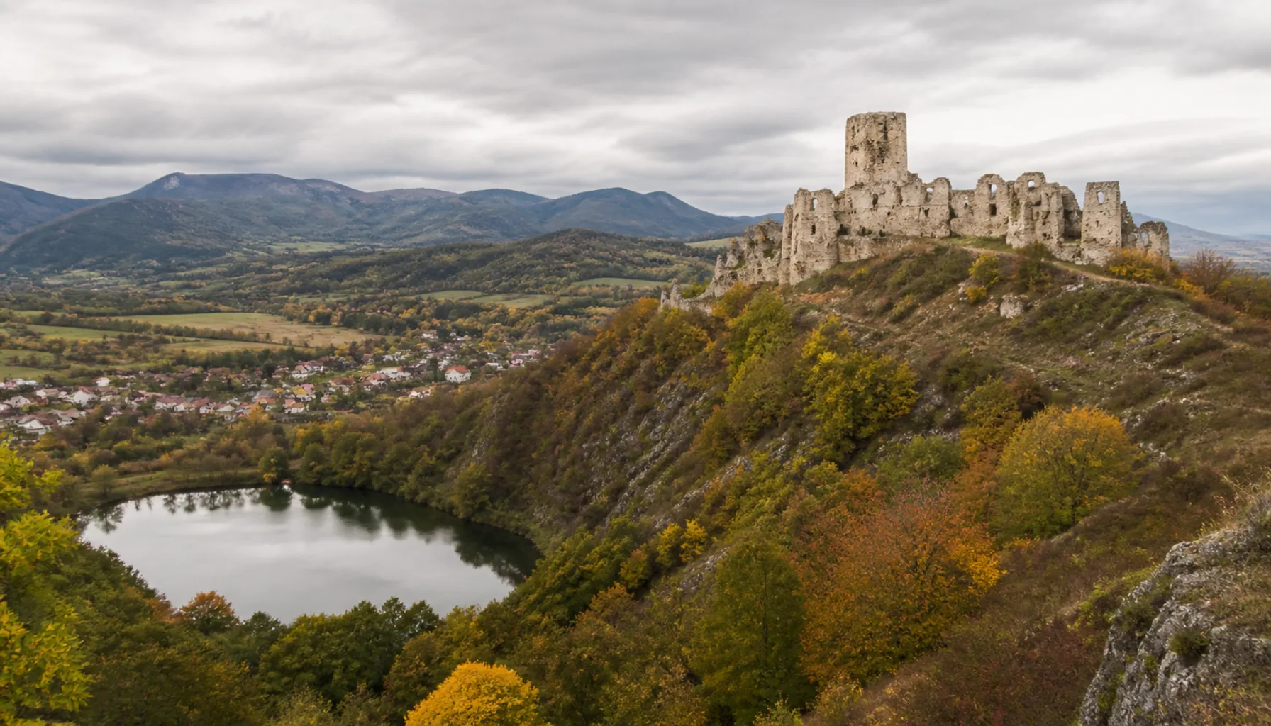
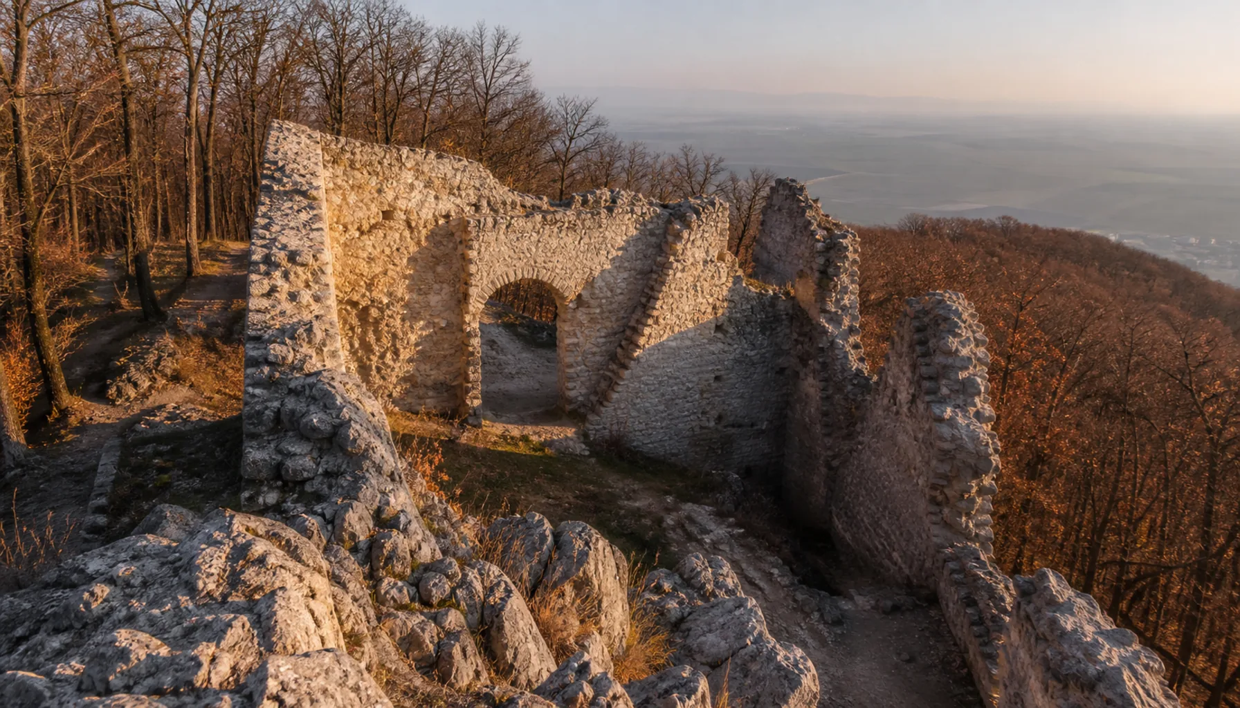
Nitra’s nearest summer escape. Jelenec sits at the foot of the Tribeč about a quarter of an hour’s drive north-east of the city, with a lake for swimming and picnicking, forest walks starting at the water’s edge, and — on the wooded ridge above — the ruins of Gýmeš Castle, a medieval stronghold whose broken walls are the classic half-day climb from the village.Najbližší letný únik Nitry. Jelenec leží na úpätí Tribeča asi štvrťhodinu autom severovýchodne od mesta — s jazerom na kúpanie a piknik, lesnými prechádzkami začínajúcimi rovno pri vode a — na zalesnenom hrebeni nad obcou — so zrúcaninami hradu Gýmeš, stredovekej pevnosti, ktorej rozvaliny sú klasickým poldenným výstupom z dediny.

A village at the foot of Zobor, its last gardens running straight into the oak wood
A village at the foot of Zobor, its last gardens running straight into the oak wood.Dedina pod Zoborom, ktorej posledné záhrady prechádzajú rovno do dubového lesa.
The ruins of Gýmeš Castle on the wooded ridge above Jelenec and its lake
The ruins of Gýmeš Castle on the wooded ridge above Jelenec and its lake.Zrúcaniny hradu Gýmeš na zalesnenom hrebeni nad Jelencom a jeho jazerom.

More to see in and around Nitra →Ďalšie tipy v Nitre a okolí →

West & NorthZápad a sever

Rail Lines, Research Fields and a Car PlantŽeleznice, polia a automobilka

West and north of Nitra the country is flatter, more open and more worked. This was always the grain side of the city, and it is here that the biggest single change of the last decade landed: the Nitra Strategic Park and its car plant, dropped onto farmland beside a village of a few thousand people. The railway that runs north out of Nitra threads through the same countryside, and the villages along it have a slightly different feel from the hill villages — longer streets, bigger fields, more sky.Na západ a sever od Nitry je krajina rovnejšia, otvorenejšia a viac obrábaná. Toto bola vždy obilná strana mesta a práve sem dopadla najväčšia zmena poslednej dekády: Nitriansky strategický park a jeho automobilka, postavené na poľnohospodárskej pôde vedľa obce s pár tisíc obyvateľmi. Železnica smerujúca z Nitry na sever prechádza tou istou krajinou a obce pozdĺž nej majú trochu iný nádych než dediny pod kopcami — dlhšie ulice, väčšie polia, viac neba.

Lužianky

IndustryPriemysel RailŽeleznica

The municipality most changed by modern Nitra. Lužianky lies immediately north-west of the city, and the Nitra Strategic Park — with the Jaguar Land Rover plant at its centre and a cluster of automotive suppliers around it — was built on the fields beside it. A farming village a generation ago, it now has a shift-work rhythm, new housing pressure and a road network rebuilt to carry lorries. The railway north out of Nitra runs through it.Obec, ktorú moderná Nitra zmenila najviac. Lužianky ležia hneď severozápadne od mesta a Nitriansky strategický park — s automobilkou Jaguar Land Rover v jadre a zhlukom dodávateľov okolo nej — vyrástol na poliach vedľa nich. Ešte pred generáciou poľnohospodárska dedina má dnes rytmus zmien, tlak na novú výstavbu a cestnú sieť prestavanú pre kamióny. Prechádza ňou železnica smerujúca z Nitry na sever.

Zbehy

Rail junctionŽelezničný uzol

A railway village in the proper sense — the line running north out of Nitra passes through Zbehy, and a branch leaves it here to run east across the country. That junction shaped the village: a station, railway housing, and the particular quiet of a place where the loudest thing all afternoon is a train that does not stop.Železničná obec v pravom zmysle slova — trať smerujúca z Nitry na sever prechádza Zbehmi a odbočuje tu vetva, ktorá vedie na východ. Táto križovatka obec sformovala: stanica, železničiarske domy a to zvláštne ticho miesta, kde je najhlasnejšou vecou celého popoludnia vlak, ktorý nezastavuje.

Čakajovce

ArchaeologyArcheológia

Ordinary to look at, famous among archaeologists. A large early medieval Slavic cemetery was excavated at Čakajovce, and the graves — hundreds of them, dug over several centuries — became one of the reference sites for understanding how the people of the Nitra region lived, buried and changed in the centuries around the turn of the first millennium.Na pohľad obyčajná, medzi archeológmi slávna. V Čakajovciach vykopali veľké včasnostredoveké slovanské pohrebisko a hroby — stovky, zakladané počas niekoľkých storočí — sa stali jednou z referenčných lokalít pre pochopenie toho, ako ľudia nitrianskeho kraja žili, pochovávali a menili sa v storočiach okolo prelomu prvého tisícročia.

Výčapy-Opatovce

Double villageZlúčená obec FarmingPoľnohospodárstvo

A double village — two settlements, Výčapy and Opatovce, joined into one municipality and now reading as a single long street along the Nitra valley north of the city. Grain and maize on both sides, the river never far away, the Tribeč on the eastern horizon.Zlúčená obec — dve sídla, Výčapy a Opatovce, spojené do jednej obce, ktorá dnes pôsobí ako jedna dlhá ulica pozdĺž údolia Nitry severne od mesta. Obilie a kukurica po oboch stranách, rieka nikdy nie ďaleko, Tribeč na východnom obzore.

Jarok & Lehota

FarmingPoľnohospodárstvo Commuter beltZázemie mesta

Two neighbouring villages on the gently rolling farmland west of Nitra, close enough to the city to have become part of its commuter belt while remaining unmistakably rural: one main street each, the church at the centre, fields to the horizon, and vineyard plots on the better-drained slopes.Dve susedné obce na mierne zvlnenej poľnohospodárskej pôde západne od Nitry, dosť blízko na to, aby sa stali súčasťou jej zázemia, a pri tom nezameniteľne vidiecke: jedna hlavná ulica, kostol v strede, polia až po obzor a vinice na lepšie odvodnených svahoch.

Nitra’s industry and employers →Nitriansky priemysel a zamestnávatelia →

South & the Wine CountryJuh a vinohradnícky kraj

Manor Parks, Big Villages and Vine RowsKaštieľne parky, veľké dediny a rady viniča

South of Nitra the hills give out entirely and the land becomes the deep, warm plain that has fed this part of Europe for a very long time. The villages here are bigger — long, wide-streeted places with a great deal of farmland behind them — and where a slope catches the southern sun there are vines. This is the Nitra wine region, one of Slovakia’s six, and its landscape signature is unmistakable: ruled rows of vine on a hillside, and below them a bank of low cellar doors set into the earth.Južne od Nitry kopce celkom ustúpia a krajina sa mení na hlbokú, teplú rovinu, ktorá živí túto časť Európy odpradávna. Dediny sú tu väčšie — dlhé sídla so širokými ulicami a s množstvom poľnohospodárskej pôdy za chrbtom — a všade, kde svah chytá južné slnko, rastie vinič. Toto je nitrianska vinohradnícka oblasť, jedna zo šiestich na Slovensku, a jej krajinný podpis je nezameniteľný: rovné rady viniča na stráni a pod nimi rad nízkych pivničných dverí zapustených do zeme.

Mojmírovce

Manor hotelKaštieľ-hotel ParkPark WellnessWellness

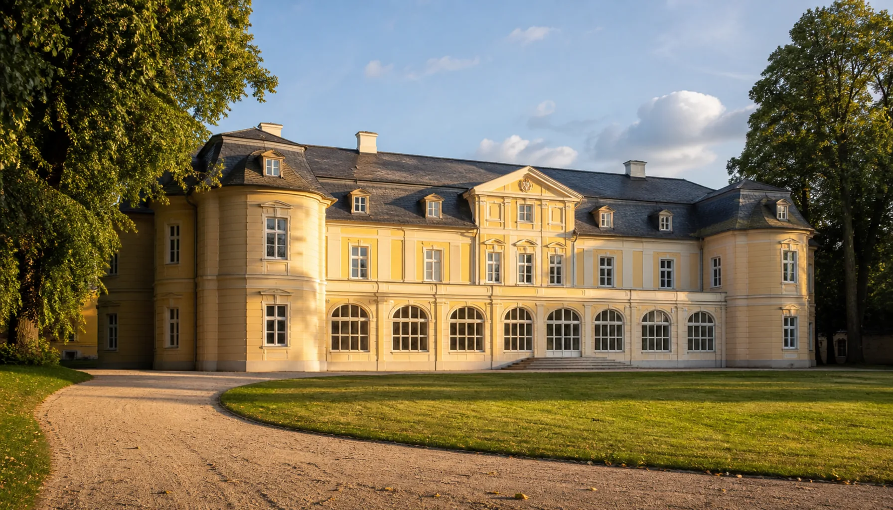
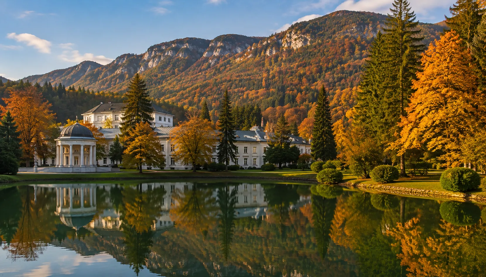
The grandest country stay near Nitra. The Baroque-Classicist manor house at Mojmírovce, with its formal frontage and its mature park, has been restored and runs as a hotel and wellness house — the obvious choice for a wedding, a conference or a weekend spent thoroughly out of the city while staying twenty minutes from it.Najvznešenejšie vidiecke ubytovanie pri Nitre. Barokovo-klasicistický kaštieľ v Mojmírovciach so slávnostným priečelím a vzrastlým parkom je obnovený a funguje ako hotel a wellness — samozrejmá voľba na svadbu, konferenciu či víkend strávený dôkladne mimo mesta, no dvadsať minút od neho.

Cabaj-Čápor

Double villageZlúčená obec Large villageVeľká obec

One of the biggest villages of the district: two settlements, Cabaj and Čápor, joined into a single municipality that stretches a long way across the flat land south-west of Nitra. It is a working agricultural village on a scale that surprises visitors who expect a hamlet — a place with its own gravity rather than a suburb of anywhere.Jedna z najväčších obcí okresu: dve sídla, Cabaj a Čápor, spojené do jednej obce, ktorá sa tiahne poriadny kus rovinou juhozápadne od Nitry. Je to pracujúca poľnohospodárska dedina takej mierky, že prekvapí návštevníka, ktorý čakal osadu — miesto s vlastnou príťažlivosťou, nie predmestie hocičoho.

Veľký Cetín & Malý Cetín

Hungarian-speakingMaďarsky hovoriace PlainRovina

A greater and a lesser village of the same name, both belonging to the Hungarian-speaking south of the Nitra district — the belt of villages where Hungarian is an everyday language and the signs at the village entrance carry two names. Flat country, large fields, and the particular cooking that comes with this border.Väčšia a menšia obec toho istého mena, obe patriace k maďarsky hovoriacemu juhu nitrianskeho okresu — k pásu obcí, kde je maďarčina každodenným jazykom a tabule pri vjazde do dediny nesú dve mená. Rovinatý kraj, veľké polia a osobitá kuchyňa, ktorá k tomuto pomedziu patrí.

Vinodol & Klasov

VineyardsVinohrady CellarsPivnice

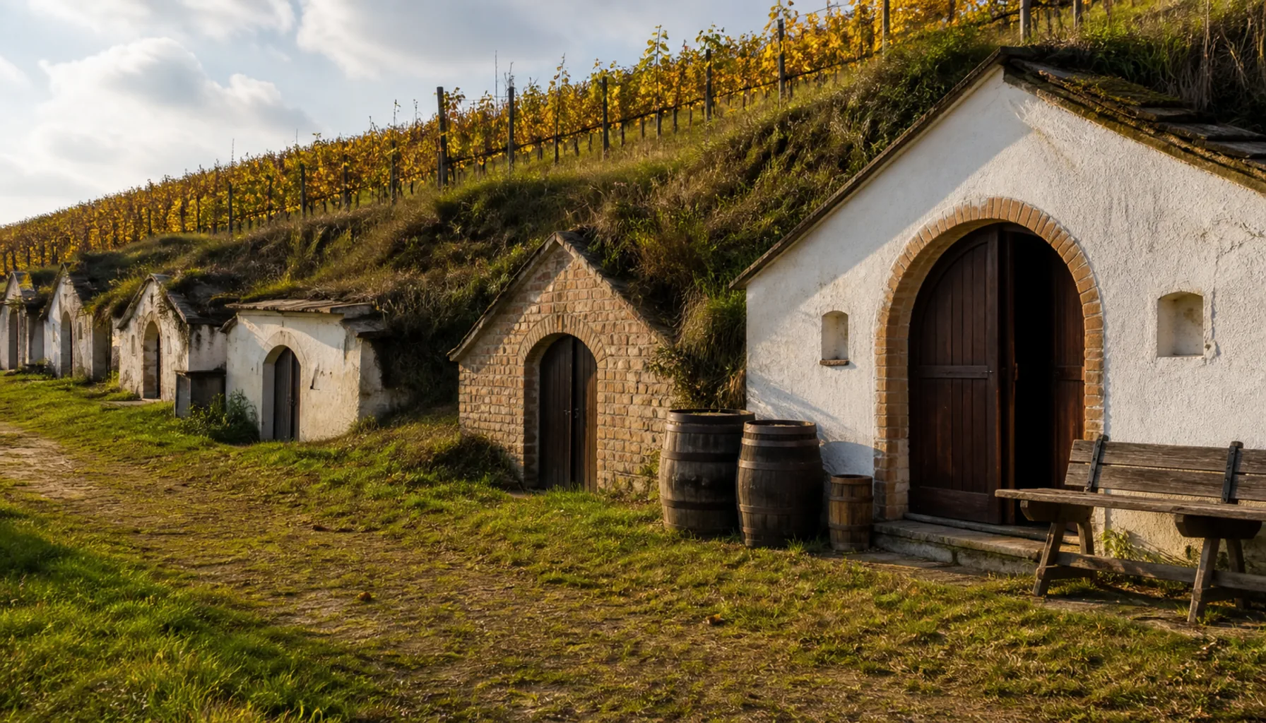
Wine villages south-east of Nitra — one of them named, plainly enough, for the valley of the vine. The picture is the same in both: vineyard blocks ruled in parallel rows up the warm slopes, wooden posts and wire, and a lane of small brick-fronted cellars dug into the hillside, each one a family’s. In autumn the whole landscape smells of fermenting must.Vinohradnícke obce juhovýchodne od Nitry — jedna z nich má vinicu priamo v názve. Obraz je v oboch rovnaký: vinohradné diely rozkreslené do rovnobežných radov po teplých svahoch, drevené stĺpiky a drôt a ulička malých tehlových pivníc zapustených do stráne, každá patrí niektorej rodine. Na jeseň celá krajina vonia kvasiacim muštom.

Golianovo & Veľký Lapáš

FarmingPoľnohospodárstvo VineyardsVinohrady

Farming villages on the gently rising ground between Nitra and the Žitava, each with vineyard plots on its warmer slopes and a long street of houses standing shoulder to shoulder. They are the everyday version of this landscape — no monument to visit, just a good reason to take the small road rather than the fast one.Poľnohospodárske obce na mierne stúpajúcom teréne medzi Nitrou a Žitavou, každá s vinohradnými dielmi na teplejších svahoch a s dlhou ulicou domov stojacich plece pri pleci. Sú každodennou verziou tejto krajiny — niet tu pamiatky na obzeranie, len dobrý dôvod ísť malou cestou namiesto rýchlej.

The restored manor house and park at Mojmírovce — the grandest country stay near Nitra
The restored manor house and park at Mojmírovce — the grandest country stay near Nitra.Obnovený kaštieľ a park v Mojmírovciach — najvznešenejšie vidiecke sídlo pri Nitre.
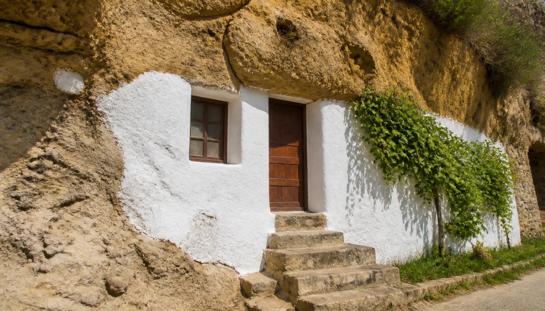
A lane of small family wine cellars dug into the hillside below the vine rows
A lane of small family wine cellars dug into the hillside below the vine rows.Ulička malých rodinných vínnych pivníc zapustených do stráne pod radmi viniča.

Staying at the manor — hotels around Nitra →Ubytovanie v kaštieli — hotely v okolí Nitry →

Further Out — a Day’s ReachĎalej — na celý deň

Beyond the RingZa vencom obcí

Push past the immediate ring and the country opens into a wider landscape of small towns and estate villages — still an easy day out from Nitra, and worth the drive for what the near villages do not have: a château with a park you can spend an afternoon in, a stud farm, a forest with wild animals in it, and cellars that have been filling barrels for generations.Za bezprostredným vencom obcí sa krajina otvára do širšieho sveta malých miest a panských dedín — stále je to pohodlný celodenný výlet z Nitry a stojí za tú cestu pre to, čo blízke obce nemajú: kaštieľ s parkom, v ktorom sa dá stráviť popoludnie, žrebčín, les so zverou a pivnice, ktoré plnia sudy už po generácie.

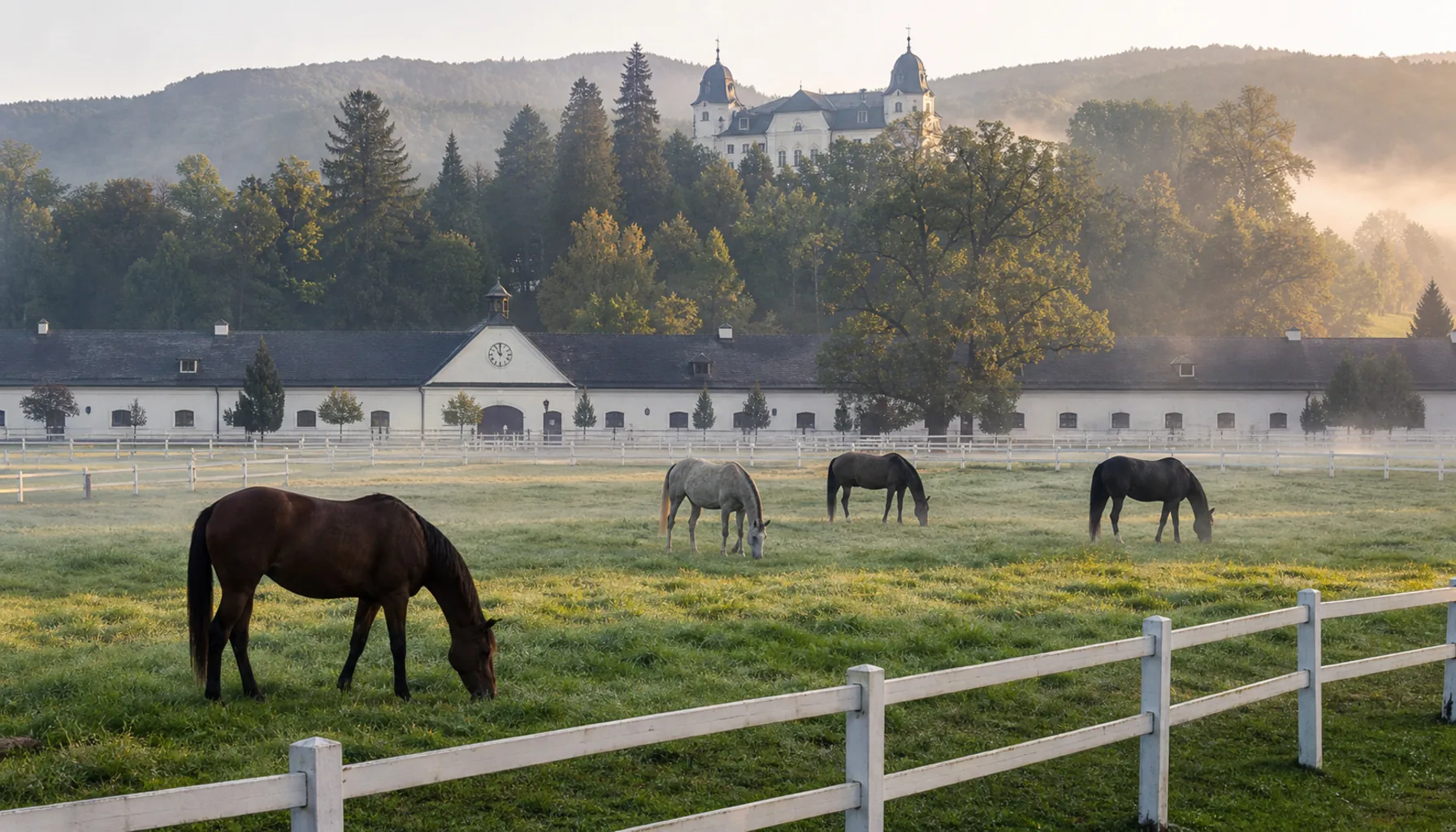
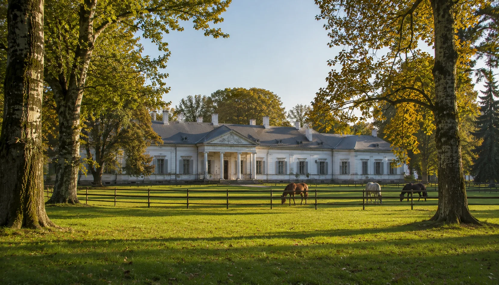
Topoľčianky lies north-east of Nitra, beyond Zlaté Moravce and under the wooded back of the Tribeč, and it is the best full day in the region. Its château is a substantial country residence with a landscaped park around it — the kind of place where the trees are the point as much as the building. Beside it stands the national stud farm, one of the great horse-breeding institutions of Slovakia, with paddocks, stables and a long working tradition. The forests behind the village hold a wildlife reserve where European bison are kept, and the village also has a serious wine-making tradition with cellars to visit. Château, horses, forest and wine, within a few hundred metres of each other.Topoľčianky ležia severovýchodne od Nitry, za Zlatými Moravcami a pod zalesneným chrbtom Tribeča, a sú najlepším celodenným výletom v kraji. Ich kaštieľ je rozsiahle vidiecke sídlo s krajinárskym parkom — miesto, kde sú stromy rovnako podstatné ako samotná budova. Vedľa neho stojí národný žrebčín, jedna z veľkých chovateľských inštitúcií Slovenska, s výbehmi, maštaľami a dlhou pracovnou tradíciou. Lesy za obcou ukrývajú zvernicu s chovom zubrov a obec má aj vážnu vinársku tradíciu s pivnicami, ktoré sa dajú navštíviť. Kaštieľ, kone, les a víno — všetko v okruhu niekoľkých sto metrov.

Vráble

Market townMalé mesto

The small town that anchors the country south-east of Nitra, on the Žitava. It is the place the surrounding villages go for a shop, a doctor and a secondary school — an unshowy working town with an industrial history of its own and a plain, useful centre.Malé mesto, ktoré drží kraj juhovýchodne od Nitry, na Žitave. Je to miesto, kam okolité dediny chodia nakúpiť, k lekárovi a do strednej školy — nenápadné pracujúce mesto s vlastnou priemyselnou minulosťou a strohým, praktickým centrom.

Zlaté Moravce

District townOkresné mesto Gateway to TopoľčiankyBrána do Topoľčianok

East of Nitra, where the road crosses the Tribeč’s southern end, Zlaté Moravce is the town at the centre of its own district and the natural gateway to Topoľčianky and the hill country beyond. A good place to break a drive.Východne od Nitry, tam, kde cesta prechádza južným koncom Tribeča, sú Zlaté Moravce mestom v strede vlastného okresu a prirodzenou bránou do Topoľčianok a do kopcov za nimi. Dobré miesto na prestávku počas jazdy.

Topoľčianky — horses in the paddocks of the national stud farm, with the château park behind
Topoľčianky — horses in the paddocks of the national stud farm, with the château park behind.Topoľčianky — kone vo výbehoch národného žrebčína a za nimi kaštieľny park.
PracticalPraktické informácie

How to Visit a VillageAko navštíviť dedinu

None of these places is a tourist attraction, and that is exactly the point of going. A village visit is a walk down one street, a look at a church, a coffee or a beer at the one place that serves it, and a conversation if you are lucky. Go on a weekday morning or a Sunday after mass and you will see the place doing what it actually does.Ani jedno z týchto miest nie je turistickou atrakciou — a práve preto sa oplatí ísť. Návšteva dediny je prechádzka po jednej ulici, pohľad na kostol, káva alebo pivo v jedinom podniku, kde ich čapujú, a s trochou šťastia aj rozhovor. Choďte v pracovné ráno alebo v nedeľu po omši a uvidíte dedinu robiť to, čo naozaj robí.

Visiting the villages around NitraNávšteva obcí v okolí Nitry
SubjectTéma What to knowČo je dobré vedieť
By busAutobusom Regional buses run from Nitra’s bus station to the villages of the district, and this is how most people without a car get about. Services are built around the school and work day: frequent early and late, sparse in the middle of the day, and much reduced at weekends. Check the current timetable before you set out — and before you rely on a return connection in the evening.Prímestské autobusy premávajú z nitrianskej autobusovej stanice do obcí okresu a takto sa väčšina ľudí bez auta dostáva von. Spoje sú postavené na školskom a pracovnom dni: husto ráno a podvečer, riedko cez deň a cez víkend výrazne menej. Pred cestou si pozrite aktuálny cestovný poriadok — a najmä predtým, než sa budete večer spoliehať na spiatočný spoj.
By railVlakom Only some villages are on a railway. The line north out of Nitra serves the settlements on that side, including a junction at Zbehy; the line running south from the city passes along the Krškany edge and on down the Nitra valley. Most of the hill villages east of the city have no station at all — those are bus or car country.Na železnici leží len časť obcí. Trať smerujúca z Nitry na sever obsluhuje sídla na tejto strane vrátane uzla v Zbehoch; trať vedúca z mesta na juh prechádza popri krškanskom okraji a ďalej dole údolím Nitry. Väčšina podhorských obcí východne od mesta nemá stanicu vôbec — tam sa cestuje autobusom alebo autom.
By bicycleNa bicykli The best way to do this, honestly. The land is flat or gently rolling, the village roads carry little traffic, and the Ponitrianska cycle route follows the Nitra valley, giving a spine you can join and leave for whichever village you fancy. Marked routes also loop into the foothills under Zobor.Úprimne — je to najlepší spôsob. Krajina je rovná alebo mierne zvlnená, po dedinských cestách jazdí málo áut a Ponitrianska cyklotrasa sleduje údolie Nitry, takže máte chrbticu, z ktorej sa dá odbočiť do ktorejkoľvek obce. Značené trasy vedú aj do podhoria pod Zoborom.
What a village looks likeAko vyzerá obec The kit is remarkably consistent: a church and a cemetery, the obecný úrad (village office) with the flag over the door, a kultúrny dom — the cultural house, which is the hall for weddings, balls and the annual feast — a shop, a krčma (pub), a fire station, and a football pitch at the edge of the built-up area. Find those seven things and you have understood the village.Výbava je pozoruhodne stála: kostol a cintorín, obecný úrad s vlajkou nad dverami, kultúrny dom — sála na svadby, plesy a hody — obchod, krčma, hasičská zbrojnica a futbalové ihrisko na okraji zastavaného územia. Nájdite týchto sedem vecí a dedine ste porozumeli.
Village feastsHody Every village keeps hody — the feast of the saint its church is dedicated to. It is the biggest day of the local year: mass, a procession, family come home from the city, a band and dancing in the cultural house, stalls and a small funfair. Dates differ village by village because the patron saints do; a village noticeboard or the municipality’s own website will say when.Každá obec drží hody — sviatok svätca, ktorému je zasvätený jej kostol. Je to najväčší deň miestneho roka: omša, sprievod, rodina prichádzajúca z mesta, kapela a tanečná zábava v kultúrnom dome, stánky a malý kolotoč. Termíny sa obec od obce líšia, lebo sa líšia patróni; kedy to bude, povie obecná tabuľa alebo webová stránka obce.
Harvest & grape harvestDožinky a oberačka Late summer brings dožinky, the harvest festival, with wheat wreaths, folk costume and a village celebration once the grain is in. Autumn brings the oberačka — the grape harvest — and with it the cellars open, the smell of fermenting must along the vineyard lanes, and the young cloudy wine that everyone drinks and nobody keeps.Koniec leta prináša dožinky — slávnosť po zvezení obilia, s dožinkovými vencami, krojmi a zábavou v obci. Jeseň prináša oberačku, a s ňou otvorené pivnice, vôňu kvasiaceho muštu po vinohradníckych uličkách a mladé kalné víno, ktoré všetci pijú a nikto neskladuje.
EtiquetteAko sa správať Greet people. A clear dobrý deň to anyone you pass on a village street is expected and instantly changes how you are received. Stay on the road and the marked paths — the strip behind a house is somebody’s garden and the vineyard rows are somebody’s plot. Ask before photographing people or going through a gate. Keep quiet around the church during mass. If you are invited into a cellar for a glass, it is a real invitation.Pozdravte. Jasné dobrý deň každému, koho na dedinskej ulici stretnete, sa očakáva a okamžite zmení to, ako vás prijmú. Držte sa cesty a značených chodníkov — pás za domom je niečia záhrada a rady viniča sú niečí diel. Pred fotením ľudí alebo vstupom cez bránu sa spýtajte. Počas omše buďte pri kostole ticho. A ak vás pozvú do pivnice na pohárik, je to pozvanie myslené vážne.
LanguageJazyk Slovak everywhere, and in the villages south of Nitra and in several of the Zobor-foothill villages, Hungarian as an everyday second language — village signs in those places carry both names. English is not widely spoken by older villagers; a few words of Slovak go a very long way.Všade slovenčina a v obciach južne od Nitry a v niektorých podzoborských dedinách aj maďarčina ako každodenný druhý jazyk — tabule tam nesú obe mená. Starší obyvatelia po anglicky väčšinou nehovoria; pár slov po slovensky urobí obrovský rozdiel.
SundayNedeľa Sunday morning is mass and the village is at its fullest and quietest at once; Sunday afternoon is the walk, the football match and the family lunch. Shops in small villages may be closed all day. Plan food accordingly, or eat in Nitra before you set out.Nedeľné ráno patrí omši a dedina je vtedy naraz najplnšia i najtichšia; nedeľné popoludnie patrí prechádzke, futbalu a rodinnému obedu. Obchody v malých obciach môžu byť celý deň zatvorené. Podľa toho si naplánujte jedlo — alebo sa najedzte v Nitre ešte pred odchodom.

Seven things make a Slovak village: a church, a cemetery, a village office, a cultural house, a shop, a pub and a football pitch.Slovenskú dedinu tvorí sedem vecí: kostol, cintorín, obecný úrad, kultúrny dom, obchod, krčma a futbalové ihrisko.

← Back to Nitra← Späť na Nitru

Each with its own pageKaždé s vlastnou stránkou

WatchPozrite si

A tour by video through the villages and boroughs that ring Nitra — the Krškany industrial edge, the manor villages, the hamlets under Zobor and the wine country of the plain.Videoprehliadka obcí a mestských častí, ktoré tvoria veniec okolo Nitry — krškanský priemyselný okraj, kaštieľne obce, dediny pod Zoborom a vinohradnícky kraj na rovine.