Banská Bystrica region · TownsBanskobystrický kraj · Mestá
TornaľaTornaľa
A bilingual market town on the Slaná in the warm southern belt of Gemer, on the main railway between Zvolen and Košice. For four decades it was called Šafárikovo, and it took its old name back at the start of the 1990s.Dvojjazyčné trhové mesto na Slanej v teplom južnom páse Gemera, na hlavnej trati medzi Zvolenom a Košicami. Štyri desaťročia sa volalo Šafárikovo a začiatkom deväťdesiatych rokov sa vrátilo k svojmu starému menu.
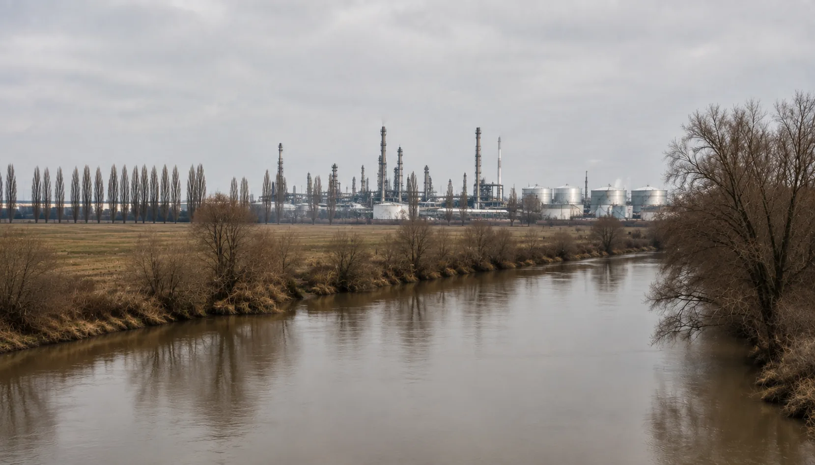
The farmed floor of the Slaná valley at Tornaľa, with the karst plateaus on the horizonObrábané dno údolia Slanej pri Tornali, na obzore krasové plošiny
Where it standsKde leží
Tornaľa lies on the Slaná in the open, low-lying south of Gemer, roughly thirty kilometres east of Rimavská Sobota and about as far west of Rožňava, with the Hungarian border a short way south. This is farming country — grain, maize and fodder on flat ground — with the limestone plateaus of the Slovak Karst rising on the northern horizon.Tornaľa leží na Slanej v otvorenom, nízko položenom juhu Gemera, zhruba tridsať kilometrov východne od Rimavskej Soboty a približne rovnako ďaleko na západ od Rožňavy, s maďarskou hranicou kúsok na juh. Je to poľnohospodárska krajina — obilie, kukurica a krmoviny na rovine — s vápencovými plošinami Slovenského krasu na severnom obzore.
Slovak and Hungarian are both everyday languages here and in the villages around, and the town is officially bilingual. Administratively it belongs to the Revúca district, whose other half lies an hour north in the mountains — an odd pairing of lowland and highland that the map has produced more than once in Gemer.Slovenčina aj maďarčina sú tu i v okolitých obciach bežnou rečou a mesto je úradne dvojjazyčné. Správne patrí do okresu Revúca, ktorého druhá polovica leží hodinu na sever v horách — zvláštne spojenie nížiny a vrchoviny, aké mapa v Gemeri vytvorila neraz.
The storyHistória
Tornaľa began as a market village of the Slaná valley and stayed one for a long time: never a mining town, never fortified, a place where the farming country came to buy and sell. Its Hungarian name is Tornalja, and it has been a mixed town for as long as there are records of who lived in it.Tornaľa vznikla ako trhová dedina v údolí Slanej a dlho ňou aj zostala: nikdy nebola banským mestom ani pevnosťou, bola miestom, kam poľnohospodárska krajina chodila kupovať a predávať. Po maďarsky sa volá Tornalja a zmiešaným mestom je odvtedy, čo vôbec existujú záznamy o tom, kto v nej býval.
The railway made the modern town. The line that runs from Zvolen along the southern edge of the Ore Mountains to Košice was built through here in the nineteenth century, and the station, the yards and the streets that followed them are most of what Tornaľa consists of today.Moderné mesto vytvorila železnica. Trať, ktorá vedie zo Zvolena popri južnom okraji Rudohoria do Košíc, tadiaľto prešla v devätnástom storočí a stanica, koľajisko a ulice, ktoré po nich nasledovali, tvoria väčšinu dnešnej Tornale.
The twentieth century moved the border across it: the First Vienna Award of 1938 put this whole southern belt into Hungary until 1945. In 1948 the town was renamed Šafárikovo after Pavol Jozef Šafárik, the Slovak scholar born at Kobeliarovo in the Gemer hills to the north-east, and it carried that name until the old one was restored after 1989.Dvadsiate storočie cez mesto presunulo hranicu: Prvá viedenská arbitráž z roku 1938 pripojila celý tento južný pás k Maďarsku až do roku 1945. V roku 1948 mesto premenovali na Šafárikovo podľa Pavla Jozefa Šafárika, slovenského učenca narodeného v Kobeliarove v gemerských kopcoch na severovýchode, a tento názov nieslo, kým sa po roku 1989 nevrátil ten pôvodný.
What to seeČo vidieť
The town itself is low-key: a long main street, the Catholic and Reformed churches of the two congregations that share it, and a market that still matters to the villages around. It is a place to base yourself in rather than a place to tour.Samotné mesto je nenápadné: dlhá hlavná ulica, katolícky a reformovaný kostol dvoch cirkví, ktoré si ho delia, a trh, na ktorom okolitým dedinám stále záleží. Je to skôr miesto, kde sa ubytovať, než miesto na prehliadku.
What is worth the journey is the Gothic Route around it: the medieval village churches of Gemer, several within half an hour, whose plain exteriors hide fourteenth- and fifteenth-century wall paintings. Kyjatice west of the town, Štítnik and Plešivec east of it up the Slaná, and a scatter of others between them are among the most important medieval interiors in Slovakia and among the least visited.Za cestu stojí gotická cesta v okolí: stredoveké dedinské kostolíky Gemera, viaceré do polhodiny cesty, ktorých strohé vonkajšie múry skrývajú nástenné maľby zo štrnásteho a pätnásteho storočia. Kyjatice na západ od mesta, Štítnik a Plešivec na východ hore Slanou a hŕstka ďalších medzi nimi patria k najvýznamnejším stredovekým interiérom na Slovensku — a zároveň k najmenej navštevovaným.
Šivetice, a short way north towards Jelšava, has a round church of St Margaret usually described as the largest Romanesque rotunda in Central Europe, with medieval painting inside it. Beyond it the magnesite country begins, and beyond that the Muráň plateau. Most of these churches are locked and opened by a key-holder living in the village, so ask before you go.V Šiveticiach, kúsok na sever smerom na Jelšavu, stojí okrúhly Kostol svätej Margity, ktorý sa zvyčajne označuje za najväčšiu románsku rotundu v strednej Európe, so stredovekými maľbami vnútri. Za ňou sa začína magnezitová krajina a za ňou Muránska planina. Väčšina týchto kostolov býva zamknutá a otvára ich kľúčnik bývajúci v obci, preto sa vopred informujte.
Work and industryPráca a priemysel
Farming is the base and always has been: some of the best arable land in Gemer lies around the town, and grain, maize and livestock still set the rhythm of the year. Around it are food processing, small workshops, building trades, and the schools, health services and offices the town carries for the villages nearby.Základom je a vždy bolo poľnohospodárstvo: okolo mesta leží časť najlepšej ornej pôdy Gemera a obilie, kukurica a chov dobytka dodnes určujú rytmus roka. Okolo toho stojí potravinárstvo, malé dielne, stavebníctvo a školy, zdravotnícke služby a úrady, ktoré mesto drží pre okolité obce.
There is no large plant here, and unemployment in this corner of Gemer has been among the highest in Slovakia for a long time. A great many households depend on work elsewhere — in Rimavská Sobota or Rožňava, across the border in Hungary, or further west.Veľký závod tu nie je a nezamestnanosť v tomto kúte Gemera patrí dlhodobo k najvyšším na Slovensku. Množstvo domácností závisí od práce inde — v Rimavskej Sobote či Rožňave, za hranicou v Maďarsku alebo ďalej na západe.
Getting thereAko sa tam dostať
Tornaľa is a stop on the Zvolen–Košice main line, with trains west through Jesenské — the junction for Rimavská Sobota — to Fiľakovo and Zvolen, and east through Plešivec to Rožňava and Košice. The main road between Rimavská Sobota and Rožňava runs through the town, and buses serve the villages of the Slaná valley.Tornaľa je zastávkou na hlavnej trati Zvolen – Košice: vlaky idú na západ cez Jesenské — uzol pre Rimavskú Sobotu — do Fiľakova a Zvolena a na východ cez Plešivec do Rožňavy a Košíc. Mestom prechádza hlavná cesta medzi Rimavskou Sobotou a Rožňavou a autobusy obsluhujú obce v údolí Slanej.
Explore TornaľaObjavujte Tornaľa
Every part of this place with a page of its own.Každá časť tohto miesta, ktorá má vlastnú stránku.